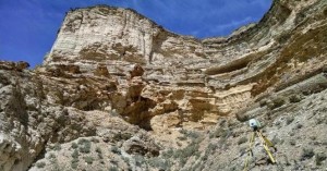
 In the ever-evolving landscape of construction and design, the quest for efficiency and accuracy remains paramount. Traditional methods of data collection and project documentation often fall short in meeting the demands of modern engineering and architectural projects. Enter laser scanning – a revolutionary technology that has reshaped the way professionals approach project workflows. In this comprehensive blog post, we’ll explore the transformative impact of laser scanning on streamlining project workflows, enhancing efficiency, and ensuring precise outcomes.
Understanding laser scanning:
- Principle of laser scanning:
- Laser scanning involves the use of laser beams to collect accurate and detailed data about the shape and dimensions of physical objects or environments.
- The scanner emits laser beams that bounce off surfaces, and the returning signals are analyzed to create a three-dimensional point cloud.
- High definition and precision:
- Laser scanning captures millions of data points per second, resulting in a high-definition and precise representation of the scanned area.
- This level of detail is far superior to traditional surveying methods, allowing for a comprehensive understanding of the project site.
- Versatility across industries:
- Laser scanning finds applications across various industries, including architecture, civil engineering, construction, industrial design, and historical preservation.
- Its adaptability makes it a valuable tool for projects of different scales and complexities.
- Time and cost efficiency:
- The speed at which laser scanning captures data significantly reduces the time required for site documentation.
- The efficiency gains translate to cost savings, making laser scanning a cost-effective solution for project workflows.
Streamlining project workflows with laser scanning:
- Precise site documentation:
- Traditional methods of surveying and documentation often rely on manual measurements, which are prone to human error.
- Laser scanning provides a precise and accurate representation of the existing conditions, minimizing the risk of inaccuracies in project documentation.
- Efficient as-built documentation:
- Laser scanning excels in capturing as-built conditions, offering a detailed snapshot of the existing structures or environments.
- This information is invaluable for renovations, expansions, or retrofitting projects, streamlining the design process by eliminating guesswork.
- Enhanced design and planning:
- The rich data collected through laser scanning allows designers and engineers to work with a more accurate understanding of the project site.
- This enhanced insight leads to more informed decisions during the design and planning phases, reducing the likelihood of unexpected challenges during construction.
- Reduced site visits and disruptions:
- Laser scanning minimizes the need for frequent site visits, as the captured data can be revisited virtually.
- This not only saves time but also reduces disruptions to ongoing operations at the project site.
- Improved collaboration:
- The three-dimensional point cloud generated by laser scanning serves as a collaborative platform for project stakeholders.
- Designers, architects, engineers, and clients can access and interact with the same data, fostering better communication and alignment on project goals.
- Accurate quantity takeoffs:
- Laser scanning provides precise measurements of existing structures and landscapes, facilitating accurate quantity takeoffs.
- This is particularly beneficial for estimating material quantities, costs, and timelines during the project planning phase.
McNeil Engineering: Harnessing high-definition scanning for project excellence
As a frontrunner in delivering comprehensive design services, McNeil Engineering leverages the power of high-definition scanning (HDS) to enhance project workflows. Here’s how McNeil Engineering exemplifies the integration of laser scanning for optimal efficiency:
- State-of-the-art technology:
- McNeil Engineering embraces state-of-the-art laser scanning technology to capture detailed and accurate data for their projects.
- Their commitment to staying at the forefront of technological advancements ensures that clients benefit from the latest innovations in high-definition scanning.
- Comprehensive design services:
- Offering a broad spectrum of design services, including civil engineering, structural engineering, land surveying, and landscape architecture, McNeil Engineering seamlessly integrates high-definition scanning into their workflows.
- This comprehensive approach ensures that projects are executed with precision and efficiency from concept to completion.
- Tailored solutions:
- McNeil Engineering understands that each project is unique, requiring tailored solutions to address specific challenges.
- By harnessing the capabilities of high-definition scanning, they provide clients with customized and effective solutions that align with project goals.
McNeil Engineering:
For those seeking excellence in design services, McNeil Engineering stands as a beacon of innovation and efficiency. Whether your project involves civil engineering, structural engineering, land surveying, or landscape architecture, McNeil Engineering is equipped to deliver timely, responsive, and economical design solutions.
Visit McNeil Engineering to explore their diverse range of services and discover how their utilization of high-definition scanning can elevate your project to new heights. With McNeil Engineering, harness the power of technology to streamline project workflows, improve efficiency, and ensure the success of your endeavors.

