 Lasers are everywhere these days. They’re featured in movies, are used to smooth aging skin and can even remove tattoos, but none of these feats are nearly as impressive as laser scanning.
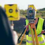
Laser scanning technology is a non-intrusive means of rapidly collecting detailed and accurate data for project documentation. In just a few minutes, laser scanning can collect enough information to build virtual walkthroughs, interference detection, containment analysis, interactive 3D models and even demolition plans. That’s just scratching the surface, though.
Lower project costs
Laser scanning technology provides a comprehensive and detailed picture of a specific plot of land. In fact, modern laser scanners can collect millions of data points (with unique x, y, and z values) in just minutes. The information that is collected can then be uploaded into a computer program like CAD, giving engineers, construction managers, and their team members access to every hill, wash, and rock formation on site.
Having access to this information prior to breaking ground or bringing in construction equipment can save a significant amount of time and money. For example, if a location’s topography is covered with large boulders, those need to be removed or eradicated prior to any construction activity.
In addition, a comprehensive 3D image of a particular job site allows architects and engineers to determine what kinds of materials they will need, as well as exact measurements for every steel beam, two-by-four, and window frame required.
Retrofitting historic buildings
Laser scanning isn’t just used for new projects. The technology plays a significant role in preserving old and historic buildings, too. In fact, almost all retrofits and remodels start with a thorough scan of the building or property. The data collected during this process provides general contractors and restoration experts with valuable information about the integrity of the structure and its foundation.
At McNeil Engineering, we’ve utilized laser scanning technology to preserve historic buildings all over the world.
- Masonic Temple – Salt Lake City, Utah
- Casino Star Theater – Gunnison, Utah
- Mumbai Mosques – India
- Garfield School – Salt Lake City, Utah
For each of these projects, we were tasked with taking a historically significant structure and preserving it for future generations. If we were forced do this on our own, it would take many months and possibly even years, but thanks to our scanning capabilities we were quickly able to get a comprehensive picture of the condition of each building and then take appropriate action.
Improving transportation
Now, we move onto transportation. Thanks to interstates, highways, and city roads we are able to get to-and-from work, run errands and take road trips, but these maze-like structures don’t just spring out of nowhere. They require extensive planning and design expertise before coming to fruition. Here, laser scanning also plays a role.
Because roads and highways must travel over mountains, bodies of water and other various forms of terrain, it’s critical that structural engineers and construction crews know what they are getting into before starting a project. Without a clear picture of the topography of a particular area, accidents, injuries, and downtime are inevitable. Using 3D CAD models and isometric drawings, challenges can be addressed before they happen.
McNeil Engineering’s Laser Scanning Team
McNeil Engineering’s 3D Laser Scan team relies on technical experience and specialized expertise to create personalized solutions for our clients. We use high definition laser scanners, total stations, and modeling and point cloud software to provide comprehensive, record surveys, models and drawings.
If you’re preparing to start work on a new project, our team is ready and willing to assist. Whether you’re breaking ground on a new structure or just need assistance retrofitting a historic building, your wish is our command. Call today to get started!


