

 The civil engineering and land surveying industries have undergone remarkable transformations, thanks to the rapid development and adoption of advanced technologies. At McNeil Engineering, we’ve always embraced innovation to provide the best services possible, and it’s clear that tools like drones, artificial intelligence (AI), and cutting-edge software are shaping the future of how we deliver accurate, efficient, and smart solutions for our clients.
Drones: Eyes in the Sky for Engineers and Surveyors
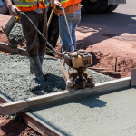
Gone are the days when land surveying was limited to hours of labor-intensive measurements with traditional tools. Drones have completely changed the game by offering fast, accurate, and comprehensive aerial data collection.
Equipped with high-resolution cameras and LiDAR (Light Detection and Ranging) sensors, drones can capture precise topographic maps, monitor construction progress, and even survey hazardous terrains without putting humans at risk. For projects involving large plots of land or hard-to-reach locations, drones provide a level of efficiency that was unheard of even a decade ago. Plus, the visual data collected helps stakeholders better understand project scopes, timelines, and challenges—making communication simpler and more transparent.
Artificial Intelligence: The Brain Behind Smarter Engineering
Artificial intelligence is another technology revolutionizing the civil engineering field. AI-powered software enables us to analyze vast amounts of data, predict future outcomes, and automate certain aspects of the design and planning process. These capabilities can save time, reduce costs, and improve precision overall.
For example, when planning infrastructure systems like roads, bridges, or drainage systems, AI algorithms can evaluate potential designs and identify weak spots before construction begins. This minimizes errors, reduces material waste, and ensures every structure meets safety regulations and environmental standards.
In land surveying, AI can help process complex terrain data, transforming raw information collected by drones into actionable insights. AI can even analyze historical land patterns and predict future shifts, which is invaluable for projects requiring long-term planning or disaster mitigation.
Advanced Software and Automation
Beyond drones and AI, there’s a whole suite of advanced software tools and automated processes that have elevated civil engineering and surveying to new heights. For example, Geographic Information System (GIS) technology allows us to map and analyze spatial data, providing deep insights into environmental, infrastructural, and geological factors that affect projects.
Building Information Modeling (BIM) is another innovation revolutionizing project planning and execution. BIM creates virtual 3D models of structures, allowing engineers, architects, and contractors to collaborate on design and construction in real-time. This leads to better coordination, fewer revisions, and safer outcomes for everyone.
Automation has also simplified routine tasks, speeding up workflows and reducing human error. Tasks like grading, excavation, and even construction robotics are proving to be transformative for the industry. With automation handling repetitive duties, engineers and surveyors can focus their expertise on solving big-picture challenges.
What This Means for the Future
As technologies like drones, AI, and advanced software continue to evolve, the opportunities are endless. They not only enhance operational efficiency but elevate the entire profession to focus on higher value tasks. Imagine a future where every project is “smart,” adaptable, and environmentally conscious—this isn’t far off, and companies like McNeil Engineering are already paving the way.
Whether it’s mapping out roads, planning public infrastructure, or ensuring bridges stand the test of time, these technologies make our processes faster, safer, and far more precise. It’s exciting to imagine a future where complex engineering and surveying challenges are met with solutions powered by technological innovation.
At McNeil Engineering, we’re proud to embrace this future, using tools to help us turn your vision into reality. And as these advancements continue to develop, we’ll remain at the forefront, ensuring every project is delivered with cutting-edge precision and care.
Drones, AI, and advanced technologies aren’t just trends—they’re here to stay. For civil engineering and land surveying firms like McNeil Engineering, these tools aren’t replacing human expertise; they’re amplifying it, making our work smarter, faster, and more impactful. And at the heart of this tech-driven transformation is a commitment to providing innovative solutions for clients, no matter the challenge.
As industries evolve, one thing remains constant: the goal is always to build better, safer, and more sustainable communities. With the tools now available to us, the future of engineering is looking brighter than ever.
Want to learn more about our work and how we integrate cutting-edge technologies into our projects? Visit www.mcneileng.com.