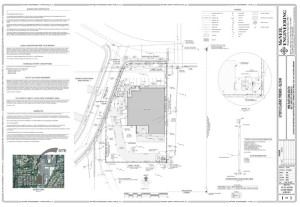
 Land surveying is a very old concept. It can be traced to the time humans began to live in settlements defined by the boundaries of ancient tribes, and the idea of land ownership. Today, land surveying is a multi-billion industry with well-defined science.
Over the years, different types of land surveys have spawned for specific needs and use cases. In this post, we’re going to examine the major types of land surveys you may need to know for investment purposes or as part of your job.
What is Land Survey?
Land surveying is the technique, profession, and science of determining the terrestrial or 3D position of points and the distances and angles between them. These points are typically points on the Earth’s surface and they are usually used to establish land maps and boundaries for ownership, as well as locations (either building corners or the surface location of subsurface features). Land surveying may also be carried out for other government required or civil law purposes.
Licensed surveyors work with sophisticated field tools, make calculations, and take images to support their survey findings. Software solutions like AutoCAD are used to draft plans and map measurements.
Types of Land Surveys
Location Survey
A location survey involves the establishment on the ground of points and lines in positions which has been determined previously by computational or graphical methods or from data obtained from documents like deeds, maps, or other sources.
This survey focuses on the improvements on the property in relation to the clear boundary lines in the property. In terms of accuracy, it involves a physical inspection of the property by the surveyor and is typically accurate within a few feet.
Location surveys are generally cheap, costing a few hundred dollars (between $250 to $500), because of the minimal work required. Here is the importance of location surveys:
1) It is used to establish the location and existence of a property
2) It shows the relationship between the property and adjoining properties
3) It highlights the discrepancies between actual property use and record description.
4) It indicates the location of physical improvements in relation to property lines
5) It’s the easiest reliable way of obtaining basic information about a property.
Cautionary Tale
A couple recently bought their dream home in Richmond county with a big backyard for a swimming pool they’ve always wanted. Two years later when they decided to build the swimming pool, the city denied their application because only half of their ‘big backyard’ was theirs. With just a simple location survey, this could have been avoided.
Boundary Survey
As the name implies, a boundary survey is used to identify a property’s boundary lines and define the true property corners of a parcel of land. It also indicated the extent of any easement or encroachments and may show limitations imposed by local or state laws.
Easements may include utility lines crossing through the property. An encroachment, on the other hand, is the use of a piece of land by an unauthorized person.
A boundary survey is done by a crew of surveyors, where the actual property corners are marked and lines determined to produce a detailed plat or map. Boundary surveys are very accurate, with little to no margin of errors. For the surveyor, this means in-depth research of public records, field research, and measurements, as well as several calculations.
In terms of cost, boundary surveys are more expensive than location surveys because they require more time, manpower, and greater precision. Although boundary surveys are quoted individually, they can range anywhere from $750 to $2,000 for one acre or less.
Here are some of the importance of a boundary survey:
1) It helps to identify the place of the borders on the floor.
2) It ensures that your fences are properly positioned near or at limits.
3) It helps to identify if houses, driveways, and other structures are crossing your borders.
4) It highlights the possible causes of future conflict.
ALTA/NSPS Land Title Survey
An ALTA/NSPS (formerly ALTA/ACSM) Land Title Survey is a complex survey product designed to aid individuals involved in commercial real estate deals. It is a comprehensive product that provides a detailed view of an existing property. It is typically used by the title insurer to delete or determine exception, or by the buyer and seller to access potential risk.
The ALTA/NSPS Title Surve is based on specific detailed requirements set forth by the American Land Title Association (ALTA) and National Society for Professional Surveyors (NSPS) and that ensures that the end-user is provided with a professional-quality, uniform, an accurate and complete representation of a property.
When it comes to land surveys, an ALTA survey is the gold standard because it meets the highest standard recognized throughout the United States. ALTA surveys typically include property boundaries, location of the main building, easement and encumbrances, encroachments, land improvements, road and property features, zoning classification, water boundaries, legal property description, and more.
A boundary survey lacks much of this information as they are not as comprehensive at ALTA surveys. Due to their complexity, ALTA Land Surveys are typically performed on commercial properties.
Construction Survey
Construction surveys are used to establish where man-made objects such as highways, bridges, as well as buildings and pipes should be located. Careful attention is made to ensure that the structure does not encroach over designated easements or property lines. Thereafter, these points are staked out onto the property. Staking provides the construction personnel with directions for executing improvements shown on the development plans.
Conclusion
Land surveying is crucial to the process of responsible land development. While this post focused on four of the major types of land surveys, there are many other types. Some of which includes:
Site Planning Surveys
Subdivision Surveys
Topographic Surveys
Foundation Surveys
Geodetic Surveys… and more.
In short summation, the types of survey you require primarily depends on your needs and purpose. Contact us today for more information. We look forward to working with you.


