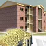
With integrated simulations, 3-D imaging, mapping, CAD and Geographic Information Systems, we can illustrate precise visual representations of a plan and project features, allowing for better cost, scheduling and design decisions.
Join Our Email List
Join Our Email List
Popular Posts
No Responses.
No Responses.
No Responses.
No Responses.
No Responses.


